Loading …
Preparing your tool
Loading …
Preparing your tool
Cookies & privacy
We only use three technically necessary cookies (login, language, your cookie decision). Google AdSense advertising is loaded exclusively with your consent — it helps cover the server costs. You can change your choice at any time under “Cookie settings” in the footer. Privacy policy
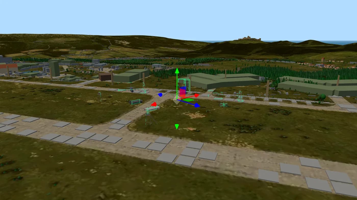
Fly over Chernarus, Livonia and Namalsk in 3D: the terrain is built from the game's real height data and satellite imagery, with buildings, vegetation, rocks, place names and points of interest on top. Switch maps with one click — drag, rotate and zoom, everything streams in as you move.
Real terrain: a 2048×2048 height grid extracted from the game files, streamed as level-of-detail chunks with the original satellite imagery on top.
Buildings, railways, vegetation and rocks: thousands of objects placed exactly where they stand in the game, most of them with their real in-game texture.
Place names and points of interest: cities, villages, wells, fuel stations, military zones and more — toggle each layer as you like.
Move around with the mouse: drag to pan, right-click (or two fingers on touch) to rotate and tilt, scroll to zoom. The camera target sticks to the terrain, so zooming always feels grounded.
The map streams what you look at: nearby terrain loads in higher detail, buildings appear within a few kilometres and vegetation close to the camera — that keeps the view fast even on laptops and phones.
Use the panel to toggle buildings, vegetation and place names, and to switch individual point-of-interest markers like wells, fuel stations or military areas on and off.
Straight from the game: the height grid is extracted from DayZ's world files (WRP), object positions from the world's object list and the imagery from the satellite texture. Nothing is hand-drawn, so the terrain matches what you see in game.
No. The 3D map runs entirely in the browser with WebGL. On first load it streams roughly 65 MB of terrain and object data; after that your browser caches it.
Chernarus (chernarusplus) and Livonia (enoch) — switch between them with the buttons above the map. Sakhal is planned as soon as its data is prepared.
Yes. Pan with one finger, rotate and zoom with two. On small screens the layer panel sits below the map.
Buildings and vegetation use simplified geometry so the whole map stays smooth. Important structures use their real shapes from the game models; the rest are footprint-accurate blocks with roofs.
Place objects on the real 3D terrain of Chernarus, Livonia and Namalsk and export a file your server loads without any mod — the only map editor that works for Xbox and PlayStation servers.
Open the Map Editor Advertising partner
Your server. Your rules.
8 to 125 slots for PC, PlayStation and Xbox. Subscription or prepaid, daily backups, DDoS protection – and every config file open for the editors on this site.
Affiliate link: same price for you, we receive a commission and use it to fund DZPage.
List it on DZPage for free: PC, PlayStation and Xbox, with a live player count, votes, comments and your own server page. No premium slots, no payment, no waiting.
8,576 visitors in 30 days · free, no premium slots
Ask in the DZPage Discord — server owners and the developer answer there. New tools get announced first.
Use our partner link and get 10% off every order at GPORTAL — servers for PC, PlayStation and Xbox.
Get 10% offAdvertising partner · Partner link: you save 10%, we earn a commission.